From rain-drenched mountains to Arctic permafrost, Alaska landslides pose hazards
- Alaska Beacon

- Sep 12, 2025
- 8 min read
Scientists with government agencies and academia depend on each other and the public to help keep track of risky spots. Federal funding may be at risk, though

By Yereth Rosen
Alaska Beacon
From the Southeast rainforest to the Arctic tundra, warming conditions are creating a variety of Alaska landslide hazards, some of them posing extreme hazards to human safety and others creating expensive problems for important infrastructure.
Just how many hazardous sites are out there? Bretwood “Hig” Higman, a geologist based in the Kenai Peninsula town of Seldovia, has done a basic inventory.
From 2012 to early this year, there have been more than 1,000 slow-moving slides of different varieties, with triggers that include receding glaciers, thawing permafrost, extreme weather or combinations of those factors, according to his calculations.
In a state where people contend with earthquakes, floods, wildfires and erupting volcanoes, it may be difficult to add another type of natural disaster to the public’s list of worries, Higman said. But elevating landslide awareness and preparedness is necessary as events increase, he said.
“It is vastly more risky than most things we deal with,” said Higman, a partner in an Alaska landslide science program created by the Massachusetts-based Woodwell Climate Research Center.
Shallow, sudden slides triggered by rain
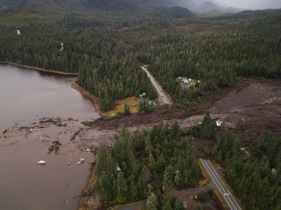
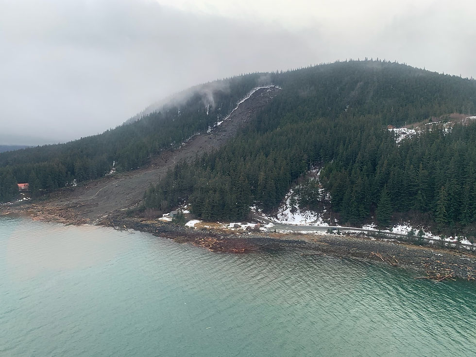
The lesson has been learned in Southeast Alaska, where catastrophic slope failures triggered by extreme rains have proved deadly. Since 2015, 12 people have been killed by landslides in Sitka, Haines, Wrangell and Ketchikan. Victims included an entire family of five killed by a sudden slide in Wrangell in late 2023.
In Southeast Alaska, steep mountains that were created through tectonic processes rise from the water’s edge, and rain is frequent. It is naturally susceptible to landslides.
“One of the primary processes that sculps the landscape in southeast Alaska is landslides and glaciers and rivers,” said Dennis Staley, a U.S. Geological Survey scientist and Alaskalandslide program leader. “When you combine rapid uplift with steep slopes with junky rock and lots of rainfall, you have all of the key ingredients for landslides.”

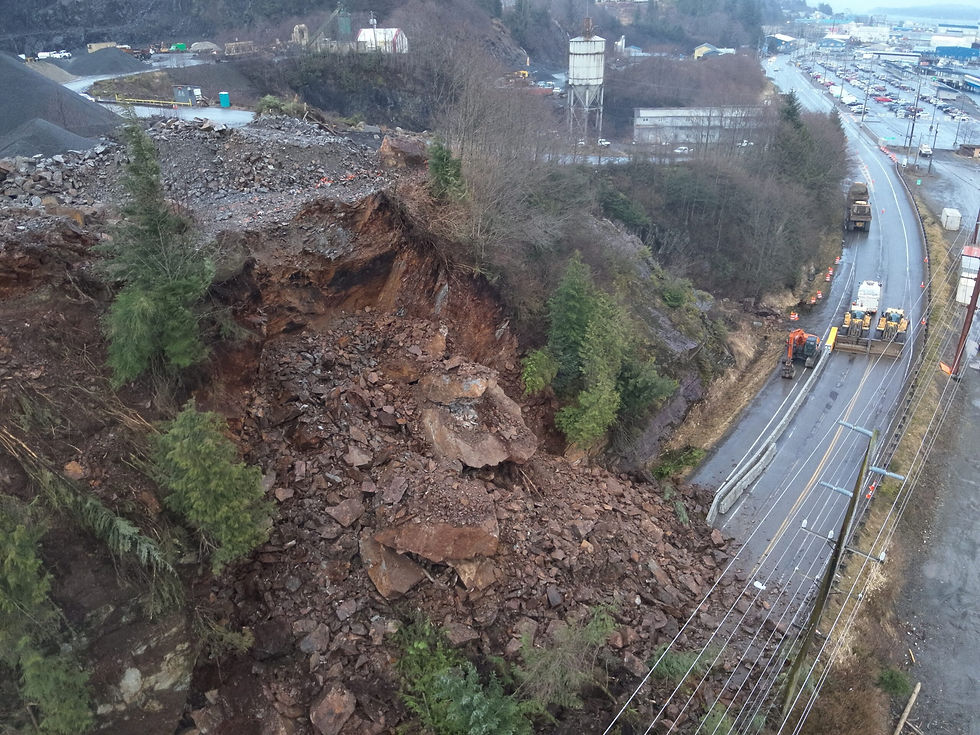
Southeast Alaska landslides are classified as shallow slides because they involve the soil, trees and other materials atop the bedrock rather than the rock itself. Those slides are numerous; the USGS recorded 162 news-reported slides in Southeast Alaska from 1990 to 2024. They are longstanding threats. A 1936 landslide in Juneau, for example, killed 15 people.
Now climate change is compounding the threat by creating more extreme rainfall events, driven by atmospheric rivers, as well as bringing more winter rain that, in other years, would be snowfall.
That means efforts to monitor landslide risks extend not just to topography studies but also the details about precipitation. Whether it is rain or snow – or rain-on-snow – has implications for slope stability, and the multiagency team studying landslide risks in Southeast Alaska has developed a prototype monitoring station to record precise qualities of the precipitation, as well as wind and temperature.
Beyond federal and state agencies’ work and that of university organizations like the Alaska Earthquake Center at the University of Alaska Fairbanks, there is focused work by tribal governments and community organizations.
The Sitka Sound Science Center, previously known for its fisheries and ocean science work, now has one of the most well-developed landslide programs. The center’s landslide program was launched in 2015, after a slide there killed three. The center now maintains a local landslide hazards dashboard, and it participates in and coordinates a variety of research projects and educational programs.
One is the Kutí project, a partnership with the Central Council of the Tlingit & Haida Indian Tribes of Alaska and other tribal partners. Named for the Lingit word meaning “weather,” the program is funded by a National Science Foundation grant awarded in 2022. The purpose is development of a more regional Southeast Alaska monitoring, warning and educational system.
The Sitka center’s work has been hampered by Trump administration budget cuts and policies. A landslide conference that the center was set to host last spring was canceled because Trump administration policies prevented federal partners from attending.
Permafrost thaw and frozen lobes
Farther north, slopes are shifting and creeping as permafrost thaws, creating hazards for infrastructure. The best-known case may be in Interior Alaska at Denali National Park and Preserve, where one of the more than 140 detected landslides along the park’s sole road interfered with travel.
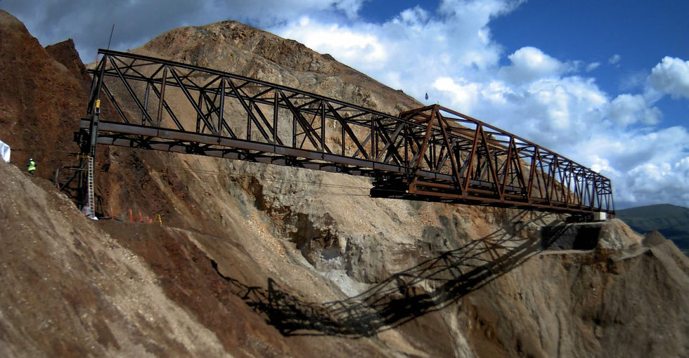
That slide, at a site called Pretty Rocks at the midpoint of the 92-mile road, had been ongoing for years, creating maintenance headaches for park staffers trying to keep the road open. In 2021, it finally made the road impassable there.

A project is underway to create a bridge over the slide area, but it is proving more complicated than originally envisioned. Early on, it was estimated to cost a bit under $100 million and expected to be completed by the 2025 tourist season. Since then, the completion date has been pushed back, with full road access expected to resume in 2027. The cost is now estimated at $150 million, a figure that does not include potential work at other landslide sites along the park’s road.
More than infrastructure at risk from Interior landslides. Last summer, when a guided rafting expedition encountered a landslide on the Nenana River just outside the park, a woman in the party was killed.
Yet farther north, masses of frozen material are working their way down to the corridor that holds the trans-Alaska pipeline. University of Alaska Fairbanks and state scientists have identified more than 200 of them in the Brooks Range. As of last year, said UAF’s Margaret Darrow, there were 99 identified along theDalton Highway, the road that parallels the trans-Alaska pipeline and the sole land route to the Prudhoe Bay oil complex.
The conglomeration of moving ice, water, crumbling rock and vegetation have their own descriptive name: “frozen debris lobes.” Darrow, the principal investigator on various UAF projects, began studying them in 2011, when she drove up the Dalton Highway for a two-family camping trip with a colleague.
The lobes, which move more quickly than thawing permafrost but are not causing sudden collapse, proved enough of a threat to the highway that the Alaska Department of Transportation and Public Facilities rerouted a section in 2018, part of a $25 million project that addressed thaw problems along the highway.
The reconfiguration proved necessary. The leftover section of highway was left in place as a test site, and the frozen debris lobe continued to flow. By late 2023, it had shoved the leftover highway section about a foot to the side, according to research led by Darrow.
In the Arctic, in Alaska and elsewhere, permafrost thaw caused by warming temperatures has triggered widespread landslides known asretrogressive thaw slumps.
Among the affected sites is the Noatak Valley in mountainous Gates of the Arctic National Park and Preserve, considered a hotpot for such slides. In that remote region, the safety of people and property is not much of an issue, but water quality can be. Numerous retrogressive thaw slumps have dumped tens of thousands of cubic meters of sediment into a single creek, according to the National Park Service.
Keeping abreast of the hazards from all types of unstable slopes in Alaska requires coordination by agencies at all levels of government, universities and other entities, said Jillian Nicolazzo, a geologist who leads the state’s landslide hazards program.
“At the moment, we can’t do it all,” said Nicolazzo, a geologist who leads the landslide program at the Alaska Division of Geological and Geophysical Surveys. “Everyone pitches in a little bit, because it is just too much for any one agency.”
Addressing federal uncertainty
The state program gets funding from the USGS, and a big boost for U.S. landslide monitoring has been provided by the National Landslide Preparedness Act signed into law in 2021. Through that act, Congress in 2021 appropriated $4 million specifically to landslide hazards in Prince William Sound.
But the law, which authorized federal funding for landslide programs, expired in 2024.
Legislation is pending in Congress to reauthorize it, with sponsors from Alaska and Washington, states with deadly slides in recent years. One bill is sponsored by U.S. Sen. Lisa Murkowski, R-Alaska, and U.S. Sen. Maria Cantwell, D-Washington. Another is sponsored by U.S. Rep. Suzan DelBene, D-Washington.
Without reauthorization, prospects for future funding are clouded.
The Trump administration’s proposed budget for the coming fiscal year would cut funding for USGS natural hazards work – which includes landslide hazards – by about a quarter, from $203 million to $157 million, according to a Congressional Research Service report.

As with the canceled Sitka conference, Trump administration policy interrupted landslide work last spring in Prince William Sound. Massive federal layoff and spending freezes prevented some planned maintenance work at the Barry Arm landslide site.
If federal support for Alaska landslide monitoring becomes spotty, there is a potential backstop: citizen science.
The Division of Geological and Geophysical Surveys earlier this year launched an online app through which members of the public can report the landslide risks they encounter. Those could be actual slides, small rockfalls, cracks or anything unusual, and the division encourages people to submit photographs.
The hope is that important information will be gathered “if people are out hunting and fishing and recreating, especially if they see a lot of landslides that we don’t,” Nicolazzo said.
Without help from the public, scientists like her have to rely a lot on things like satellite imagery, she said. “I mostly sit at a computer and look at Google Earth. The images can be years old,” she said.
So far, the Alaska Landslide Reporter app has not been promoted or used much. But Nidolazzo is hopeful about its eventual utility.
Public awareness is, for now, the prime solution to the landslide problem in a place as big, mountainous, wild and fast-changing as Alaska, Nicolazzo said.
“I think educating people about the risk is the best we can do at this point. Because the area is so large and people are everywhere,” she said.
• Yereth Rosen came to Alaska in 1987 to work for the Anchorage Times. She has been reporting on Alaska news ever since, covering stories ranging from oil spills to sled-dog races. She has reported for Reuters, for the Alaska Dispatch News, for Arctic Today and for other organizations. Alaska Beacon is part of States Newsroom, the nation’s largest state-focused nonprofit news organization. This story has been supported by the Solutions Journalism Network, a nonprofit organization dedicated to rigorous and compelling reporting about responses to social problems, http://solutionsjournalism.org.


