

.png)
Significant avalanche risk in Behrends area Tuesday night, city warns; heavy rain and high winds forecast
- Mark Sabbatini

- Jan 13
- 3 min read
Evacuation advisory says peak snowslide danger will last until Wednesday morning; flood advisory for Jordan Creek near mall until 9 a.m. Wednesday
By Mark Sabbatini
Juneau Independent
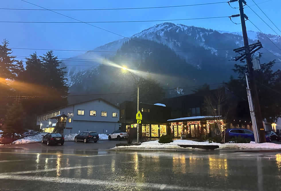
Heavy rain and gale-force winds are expected overnight Tuesday in Juneau, prompting advisories from public agencies and the announced closure of Thane Road beginning at noon and lasting until at least 6 a.m. Wednesday.
Avalanche risk on Behrends path is increasing significantly and will peak late today and into tomorrow morning due to heavy rain, high winds, and warming temperatures at high elevations.
The City and Borough of Juneau issued an alert at 5:45 p.m. Tuesday stating "Avalanche risk on Behrends path is increasing significantly and will peak late today and into tomorrow morning due to heavy rain, high winds, and warming temperatures at high elevations." An evacuation advisory is in effect for the area.
Between two and three inches of rain are expected in Juneau from Tuesday morning through Wednesday, said Greg Spann, a National Weather Service Juneau meteorologist. While that’s similar in intensity to the record 1.78 inches that fell Saturday, he said the bigger concern for forecasters is the wind.
"We’re going to get a very good slug of winds coming up with this system as well, with gusts of 65 miles per hour and potentially higher," he said.
Flooding in the vicinity of the Jordan Creek Center was reported early Tuesday morning by the weather service, with a flood advisory in effect until 9 a.m. Wednesday.
"Persistent warm temperatures combined with recent rain on existing snowpack has (led) to a gradual rise in Jordan Creek, going near Minor Flood stage," an advisory posted at 4:30 a.m. states. "Going into Tuesday, with warm temperatures and rising snow levels expected to continue in combination with additional rainfall from an incoming system, a Flood Advisory has been issued for Jordan Creek."
The Thane Road closure is due to avalanche risk following heavy snow since the end of December that was then followed by record rainfall during the past weekend, causing unstable slope conditions, according to the Alaska Department of Transportation and Public Facilities.
"If a natural avalanche reaches the roadway, DOT&PF may not be able to safely remove avalanche debris until conditions improve through mitigation work or a natural decrease in avalanche hazard," a post at DOT’s Facebook page at 5:17 p.m. Monday states.
The city’s cold-weather emergency shelter in Thane will remain at its existing location Tuesday night, according to Jennifer Skinner, executive director of St. Vincent de Paul Juneau, which operates the shelter.
The Behrends slide path beneath Mount Juneau also remains under an avalanche evacuation advisory as of Monday, City Manager Katie Koester said during a briefing about storm-related developments to the Juneau Assembly at its meeting at City Hall. A shelter at Centennial Hall will remain open while such advisories are in effect.
All Juneau public schools are open, according to Kristin Bartlett, chief of staff for the Juneau School District, but there will be no bus service Wednesday at the following sites:
Satellite streets in Switzer Trailer Park
5th Street in Douglas
Glacier Avenue/Glacier Highway between Highland Drive and Bartlett Regional Hospital
Thane Road
CBJ announced Tuesday the municipal recycling center in Lemon Creek will be closed until at least Friday "due to damage to operational equipment caused by the heavy precipitation from the winter storm."
"CBJ RecycleWorks staff are working on repairs and hope to open to the public on Saturday, January 17," the notice states. "Staff will provide notice and open the facility as soon as possible if repairs are completed early."
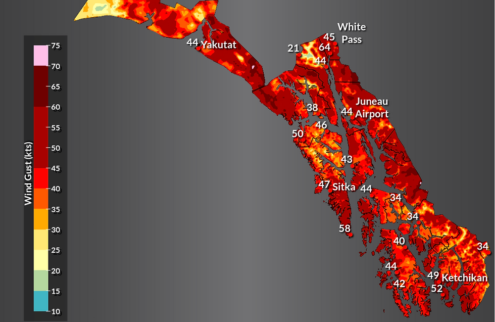
A high wind warning for most of Southeast Alaska is in effect between noon Tuesday and 9 p.m. Wednesday, according to the weather service. Sustained winds of 30 to 40 miles per hour, with gusts exceeding 70 miles per hour, are expected.
Heavy rain is also forecast throughout the region Tuesday, according to the weather service.
"Total rainfall amounts will be around 1.5 to 3.5 inches with gusty winds up to 65 mph possible during the event," a forecast updated at 3:39 p.m. Monday states. "The heaviest rainfall rates will occur during the afternoon and evening hours, tapering off during the overnight hours. Strongest wind gusts will follow the heaviest rain, occurring during the evening and overnight hours, then tapering off Wednesday morning."
• Contact Mark Sabbatini at editor@juneauindependent.com or (907) 957-2306.


%20(3).jpg)