

.png)
Juneau sets second record snow day this month with 9.2 inches on Monday
- Mark Sabbatini

- Dec 16, 2025
- 2 min read
End of storm means another cold snap is expected for the rest of this week, according to the National Weather Service
By Mark Sabbatini
Juneau Independent
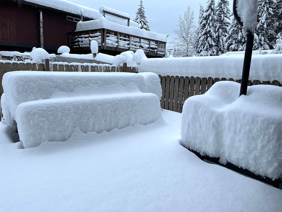
December is imposing itself fiercely on Juneau with alternating periods of bitter cold and record snow, including an all-time high of 9.2 inches of snowfall on Monday and temperatures forecast to drop back down to near zero by Wednesday night, according to the National Weather Service Juneau.
Monday’s snow and occasional blizzard-like conditions due to gusting winds resulted in school, businesses and other closures. Juneau School District and Capital Transit buses are on snow routes Tuesday, but other facilities are generally operating on normal schedules.
However, up to two more inches of snow and wind gusts to 40 mph are expected to cause more problems with blowing snow on Tuesday, the Alaska Department of Transportation and Public Facilities stated in a post at 9 a.m. on its official Facebook page.
"DOT&PF crews have been out responding and plowing," the post notes. "Road conditions are currently reported as icy after being plowed."
Saturday’s snowfall at Juneau International Airport broke the old record for Dec. 15 of 8.7 inches set in 1971, according to NWS Juneau. A record was also set on Dec. 6 when the 9.6 inches of snowfall broke the previous record of 7.2 inches set in 1975.
A total of 29.3 inches has fallen this month as of Monday, according to the weather service. The mean snowfall for December in Juneau is 20.2 inches and the record is 54.7 inches set in 1964.
In between the two record days of snow this month was an extended cold snap that saw temperatures drop into single digits, with wind chills well below zero. Warnings about hypothermia and freezing pipes were issued by local officials, and the city’s cold-weather emergency shelter was kept open 24 hours a day last week instead of its normal routine of closing during the day. The warming shelter closed at 6:45 a.m. Tuesday morning, returning to normal hours of 9 p.m. to 6:45 a.m.
The extended forecast for Juneau calls for mostly cloudy skies and windy conditions starting Wednesday, with temperatures gradually dropping. A high of about 20 degrees and low of five degrees are forecast Wednesday, with a high of about 10 degrees and low near zero on Monday.
The alternating snow and cold are part of a wider weather pattern affecting the area, said Erin Brunsen, a NWS Juneau meteorologist, in an interview Tuesday.
"Last week, what was happening was we were getting a bunch of low-pressure systems coming up from the south and sending fronts over the Panhandle," she said. "And since we were already cold, all that precipitation fell as snow. And then what we're seeing right now is we're going more into the outflow pattern again. So we have that high pressure over Canada for the Yukon and British Columbia area, and that is just pushing northerly flow and those cooler temperatures over the Panhandle."
• Contact Mark Sabbatini at editor@juneauindependent.com or (907) 957-2306.


.png)
.jpg)