.png)

Flood preparations kick off with ‘preseason’ open house

City and partner agencies share resources, updates and what to expect this year
By Ellie Ruel
Juneau Independent
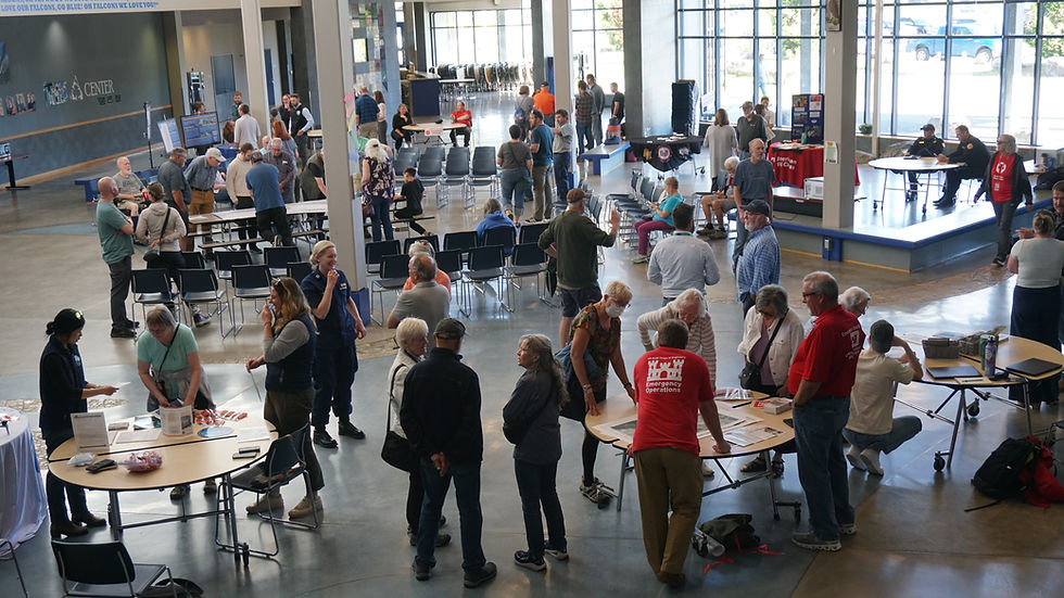
As another late-summer glacial lake outburst flood from Suicide Basin looms, Mendenhall Valley residents and several state, federal, and local agencies have started preparations. A Tuesday night flood-preparedness open house hosted by the City and Borough of Juneau at Thunder Mountain Middle School commons offered resources and the opportunity to ask questions.
“We have a lot of meetings where we’re in that auditorium,” said Ryan O'Shaughnessy, the Emergency Programs Manager for CBJ. “We wanted to make some space, create some things to talk with people.”
City leaders say the first phase of HESCO barriers succeeded in preventing a major disaster when a glacial lake outburst flood last August crested at a record 16.65 feet, with officials stating there was no damage to 90% of homes in the flood zone.
O'Shaughnessy said the city is adapting this year’s flood preparation strategy based on last year’s flood experience.
“Last year was the first year that we had battle tested HESCO barriers and we learned a lot,” he said. “We learned a lot about how to operate behind loaded flood barriers. Last year, we saw seepage coming out of the ground and through the barriers, and we fully anticipate seeing more of that and seeing that again this year. But we have updated our safety protocols to keep our personnel responding in the area behind the loaded barriers and keep everybody safe.”

Part of keeping everyone safe, he said, is urging those in the flood zone to heed evacuation advisories and stay away from the barriers and bridges.
“When these barriers fail, it's like a flash flood,” he said. ”You can watch barriers fail in Iowa and the Mississippi River. You can watch what happened in King County this past year. It is fast. There is not time to evacuate once the barriers have been breached or overtopped, there is no time to evacuate. We've been very, very lucky to not have a fatality during the course of the release of Suicide Basin.”
One of those close calls came when a downed tree speared a section of barriers behind Dimond Park Field House, knocking out about 15 feet of the flood wall. Some residents were concerned about trees becoming a problem again this year.
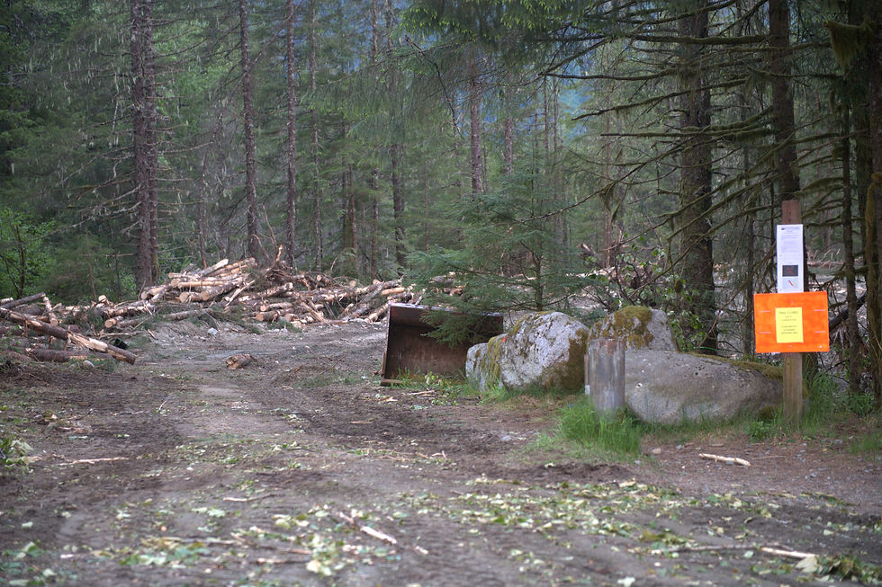
O’Shaughnessy explained that trees near the river are being cut down and chopped into smaller, less destructive pieces.
Britta Tonnessen is the community disaster program manager with the American Red Cross of Alaska. She said she wanted people to be aware of the evacuation shelter, which will be set up at Floyd Dryden again this year.
“In Florida and places where disasters happen frequently, people are really more prepared to evacuate,” she said. “Not everyone, but I think it's more of a comfort zone, and I think we hope that will happen here, 'cause I've heard some pretty scary stories from people who didn't evacuate.”
She said last year, fewer than 10 people stayed at the shelter, and encouraged those with questions about individual evacuation needs to reach out and have a go bag ready.
This year, Capital City Fire/Rescue is also increasing response personnel and creating a “robust operational plan” including boat teams on both sides of the Mendenhall River and helicopter landing spots.
“We're preparing for the worst-case scenario in case we lose access to the bridges this year,” said Fire Chief Tom Hatley. “We always prepare for the worst-case scenario. I mean, usually 99% of the time, it never happens.”
Mark Miller and Don Gottschall both live in the flood zone and had questions about pump placement at narrower sections of the river.
“We will be more prepared,” Miller said. His garage flooded in 2024. “If the flood is predicted to peak at one in the morning we are not going to be there waiting.”
Gottschall is a retired civil engineer and had questions for the city engineering department. He gestured to the two bridges crossing the Mendenhall River on the map behind him, marked with planned pump locations.
“When they built them, they couldn't imagine if they could have that much water,” Gottschall said. “Speed that up, and it backs up behind this bridge. And they've even got a pump here, you'll see, to get in front of the bridge.”
About 40 industrial pumps provided by the U.S. Army Corps of Engineers are being installed at various points along the river to drain potential seepage. They can run continuously for up to 24 hours without being refueled.
An earthen berm near Back Loop Bridge has been added to the mitigation plan for Phase 2 to prevent water from overtopping onto the road. When completed, it will be about 10-12 feet tall and 50-60 feet wide, stretching 1,100 feet in length. The Back Loop Bridge closed Wednesday for construction to begin.
“After further consideration and collaboration with USACE and USFS experts, an earthen berm was identified as a more resilient temporary mitigation measure that would be less vulnerable to damage from vehicle traffic and require less maintenance and future repairs,” a joint news release notes.
Debbie Penrose-Fischer, leader of the group Juneau Flood Solutions Advocates, said she attended to beg for a solution that works for View Drive — a street unprotected by the temporary flood levee. She found out there wasn’t a good answer.
“I did find out they could have sandbags,” she said. “Otherwise I just came to see what was happening with the Corps, because they’re not accessible.”
She said that after starving for some information, it was refreshing to engage in debate and have the opportunity to ask USACE questions. Still, she said the biggest challenge is waiting for a long-term solution.
“We need to dig the tunnel, tap the lake,” she said.
JFSA is adding more river-monitoring cameras for its Eyes on the River project, and partnering with the city to bring sandbags into neighborhoods, as well as organizing community meetings with scientists and mining representatives in pursuit of a long-term solution. Penrose-Fischer said organizing that information and keeping up with city meetings is akin to a full-time job.
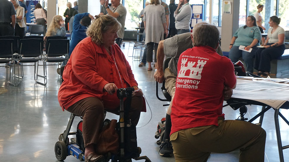
The Army Corps fielded a plethora of questions at the open house, mostly about how flood mitigation work was progressing and why the barriers are being updated to withstand an outburst flood flowing at 63,500 cubic feet per second (cfs).
“We had a lot of questions on phase one of how that came about, that things got raised, armoring got on the bank,” explained Herschel Deaton, chief of emergency management. “What happened was we did modeling, and our modeling showed we want to protect between 63,500 and 70,000 cfs — cubic feet per second. Juneau wanted us to protect, before this GLOF, to 90,000 cfs. We had no capability to do that work to get us to where we needed to get to before the 2026 GLOF.”
Jason Amundson is a professor at the University of Alaska Southeast and has been studying the floods for years. He said that based on preliminary estimates from a drone survey last week, the volume of the basin hasn’t changed significantly.
“What we know just from here and from other glaciers as well is that the size of the flood scales with the volume. It is not a perfect relationship, so we can't say, “Oh, if there’s this volume, this is what the discharge is,” he said. “I can imagine it being bigger than last year, but it's hard to imagine it being dramatically bigger, just because the volume is pretty similar.”
Amundson said that rates do play a role, since the mechanism of the release depends on how fast the water pressure bores a hole in the glacier, and it takes time for the tunnel underneath to get larger. Last year he noted the rate was faster than expected and that each year is different in terms of output and rate.
“I guess we don't know what the speed limit is,” Amundson said. “Maybe it could get even faster, but there's some physical constraints on how fast it is.”
Many of the questions he received Tuesday were about some of the numbers used in engineering estimates. At an Assembly Committee of the Whole meeting in May, USACE said in the next 15 years, there’s a 26% probability — with wide margins of variance — that a flood cresting at 20 feet and moving at 90,000 cfs impacts over 2,000 homes in the Valley. Based on modeling, the temporary flood wall is being upgraded to withstand a 63,500 cfs flood before the 2026 event.
“Thinking about the probability is hard, because it’s not the same as a rainstorm, like what’s the probability of there being an atmospheric river?” Amundson explained. “It’s more like, ‘What’s the probability based on data over time?’ My sense right now is that for the next year or two it’s hard for me to imagine that (the flood) being twice the size that it was last year. I think it could be like a couple percent bigger, maybe 5% bigger.”
He said that the engineers have to look at events 10 years in the future, which can shift the estimates upwards.
“That's why you see these numbers that are bigger than what we’ve seen before,” he said. “Then on top of that, they have to build infrastructure that doesn't fail.”
The UAS research team uses a combination of drone surveys and camera images to track the basin’s volume. After it drains, they can also map the bottom of the basin to get a better idea of the bathymetry.
“One of the biggest drivers of changes over the last 15 years has been the floating ice in the basin,” Amundson said. “And so once the ice is floating, which it is now, then we can — from the drone surveys — we can track how much ice is in the basin, because we know that what we see is the part that's sticking out about water. That's 10%.”
Amundson joked that this is one of the only times he’s rooting for a glacier to get smaller. As the Mendenhall Glacier thins, the basin won’t be able to hold as much water. In the last year, he said the glacier thinned by 10 to 15 feet in the vicinity of Suicide Basin.
“If it keeps at that rate, we’re going to see it eventually getting smaller,” he said.
He and other researchers at UAS are collaborating with Carnegie Mellon University to release a tracking tool for glaciers that could pose a risk across the state.
“The idea is to take what we've learned here and start thinking about other places across Alaska where there could be flood basins,” he said. “Doing the sort of work that maybe someone should have done here 50 years ago, but no one was thinking about it.”
Flood forecasting updates for Juneau will have a slightly increased frequency based on feedback from last year, said National Weather Service Warning Coordination Meteorologist Nicole Ferrin.
“Right now we're updating the Suicide Basin monitoring page — Aaron Jacobs, in particular, every Monday,” she said. “And so we'll do that at least once a week for now, and then as we get further into the summer, we'll start increasing the cadence.”
She said many of the questions the Weather Service answered at the meeting addressed competing factors about how fast the basin fills and when it will release. A common fear was that record-breaking snowfall this winter would cause a larger outburst, to which she said the flood size is dependent on the basin size. The basin is filling at a mostly average rate this year.
“That doesn't tell us anything about when it's gonna release because if we have a really hot June and July, it could go faster,” Ferrin said. “Similarly, if we have a really wet July, that could cause it to fill faster just because of all of the snowmelt. But if we have a cloudy, cool summer, that fills it slower. Those days don't get as much inflow as the hot, sunny days and really wet days, so it's so dynamic in that way.”
Weekly updates about water levels in Suicide Basin are available at the Weather Service’s website and the Juneau Glacial Flood Dashboard. The U.S. Geological Survey turned on all cameras and gauges monitoring the basin Wednesday, and another camera overlooking the basin’s overflow channel is set to be installed in the next few weeks. For the last two years, the basin has released in early August.
Multiple other preparation and informational events are planned in the next two months including:
Juneau Flood Solution Advocates will host a community discussion with UAS professor and researcher Eran Hood on June 25 from 6-8 p.m. at Chapel by the Lake.
The National Weather Service plans a “The People Behind Your Forecast” Juneau Open House on June 27 at its weather station at 8500 Mendenhall Loop Road from 12-4 p.m.
A June 30 community readiness panel hosted by KTOO at Thunder Mountain Middle School from 6-7:30 p.m. Confirmed panelists include representatives from USACE, CBJ, NWS, UAS and U.S. Geological Survey.
A sandbagging workshop at Dimond Park Field House from 11 a.m.-3 p.m. on July 11, with representatives from USACE. Sandbag filling and distribution events are also scheduled on the following two Saturdays.
• Contact Ellie Ruel at ellie.ruel@juneauindependent.com.